Aquifer Analysis and Groundwater Services
Aquifer analysis evaluates groundwater flow, quality, and potential contaminant migration to support environmental investigations, regulatory compliance, and water resource planning.
What Aquifer Analysis Is and Why It Matters
Aquifer analysis is the practice of evaluating groundwater systems to understand how water and dissolved constituents move through the subsurface. This includes characterizing:
Hydraulic conductivity and transmissivity
Groundwater flow direction and gradients
Storage properties and recharge conditions
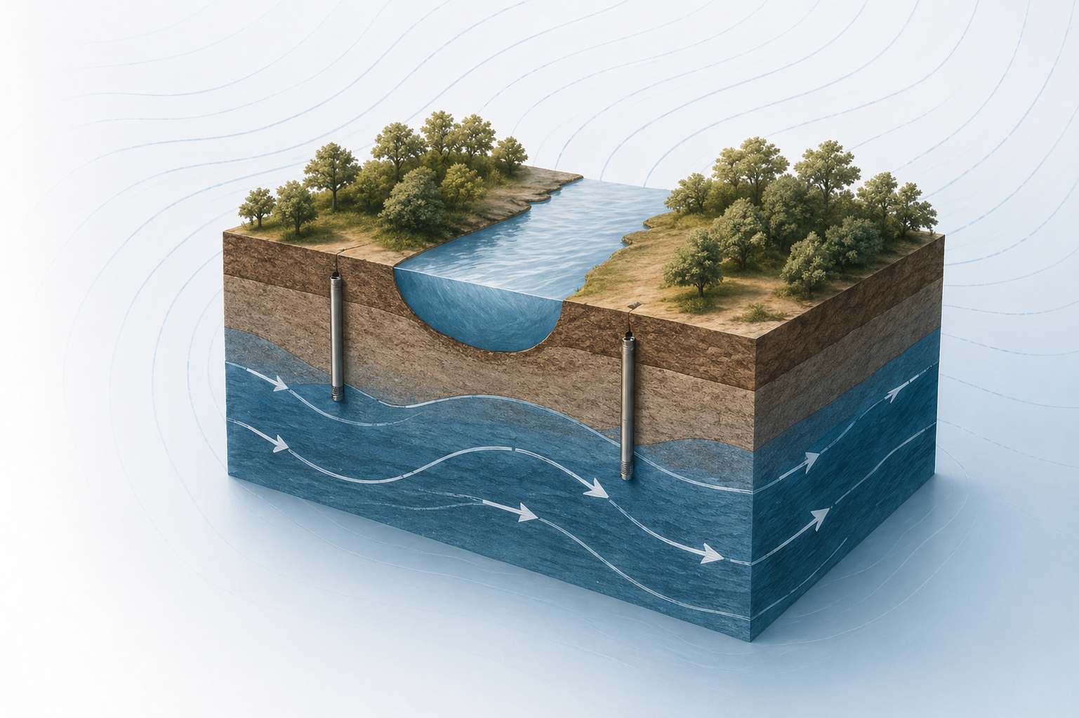
Interaction between groundwater and surface water
How contaminants migrate over time
These evaluations are critical for:
Designing effective remediation systems
Planning construction dewatering
Evaluating land use and development impacts
Supporting water supply and resource management
Performing fate and transport modeling for regulatory decision-making
Without a proper hydrogeologic understanding, engineering designs and cleanup strategies are often over- or under-designed, increasing cost, risk, and uncertainty.
Aquifer analysis is often a critical component of environmental due diligence and remediation strategy, particularly when groundwater conditions directly impact regulatory approval, development feasibility, or long-term liability.
When Aquifer Analysis Is Required
Aquifer analysis is performed when groundwater conditions influence environmental risk, regulatory requirements, or project feasibility. It is typically required to understand how groundwater moves beneath a site, how contaminants may migrate, and how those conditions impact development, remediation, or long-term liability.
Common use cases include:
Groundwater Contamination Investigations
Aquifer analysis is used to evaluate how contaminants move through subsurface conditions, including groundwater flow direction, velocity, and potential migration pathways. This is critical when delineating contamination identified during a Phase II Environmental Site Assessment and determining the extent of impact.
Phase II ESA Subsurface Evaluations
During Phase II investigations, aquifer characteristics influence sampling strategy, well placement, and interpretation of groundwater data. Understanding site-specific hydrogeology ensures that environmental conditions are accurately defined and defensible for lenders, regulators, and stakeholders.
Remediation Design and Plume Tracking
Aquifer analysis supports the design of remediation and corrective action strategies by identifying how contaminants behave in groundwater, informing system selection, implementation approach, and long-term performance monitoring. It is also used to monitor plume stability, migration, and response to remediation over time, ensuring cleanup efforts are effective and aligned with regulatory expectations.
Regulatory Compliance and Reporting
Many environmental programs require a clear understanding of groundwater conditions to meet compliance standards. Aquifer analysis is often necessary to support reporting, demonstrate plume containment, and satisfy agency requirements for site closure or continued monitoring.
Water Supply and Hydrogeologic Studies
Aquifer analysis is used to evaluate groundwater availability, quality, and sustainability for water supply planning. This includes assessing potential impacts from nearby contamination, groundwater withdrawal, or site development activities.
Understand Subsurface Conditions and Make Confident Water-Related Decisions
Groundwater plays a critical role in environmental planning, site development, remediation design, and water resource management. Whether you are evaluating natural site conditions, designing dewatering systems, modeling contaminant transport, or supporting regulatory decisions, understanding how an aquifer behaves beneath a site is essential.
At CRB, we help clients evaluate and interpret subsurface water systems using technically sound, scientifically defensible aquifer analysis and groundwater modeling. Our work supports engineering design, regulatory compliance, remediation planning, and long-term resource management decisions.
OUR PROCESS
How CRB Conducts Aquifer Analysis & Groundwater Modeling
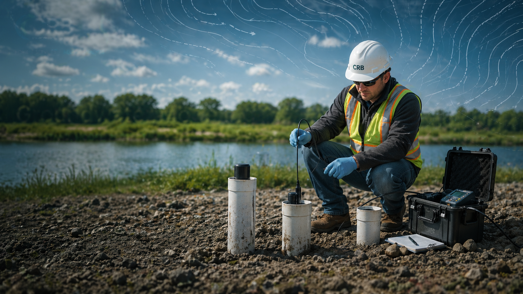
CRB’s aquifer analysis begins with a comprehensive evaluation of site conditions, geology, historical data, and project objectives, followed by the development of tailored field investigations, groundwater monitoring networks, and supply modeling strategies that support long-term resource management and informed decision-making.

Aquifer Pumping Tests: Field testing to determine hydraulic properties and aquifer response.
Groundwater Flow & Transport Modeling: Use of analytical and numerical models to simulate groundwater movement and contaminant migration.
Flow Net & Recharge Analysis: Visualization and quantification of flow pathways and recharge mechanisms.
Three-Dimensional Finite Element Modeling: Advanced modeling for complex hydrogeologic settings.
Vadose Zone Analysis: Evaluation of unsaturated zone infiltration, vapor transport, and solute migration.

The CRB Aquifer Analysis & Groundwater Modeling Process
-
We evaluate geology, historical data, and project goals.
-
We perform pumping tests, install wells, and collect hydrogeologic data.
-
We simulate flow and transport using appropriate analytical or numerical models.
-
We prepare defensible reports and provide practical recommendations.
Frequently Asked Questions
-
Aquifer analysis and groundwater modeling are scientific methods used to understand how groundwater moves, how much water is available, and how a project may affect the aquifer.
These studies are used to:
Evaluate water supply capacity
Predict groundwater flow and drawdown
Assess impacts from pumping or development
Support permitting and regulatory approvals
Design dewatering or remediation systems
Protect water resources and nearby properties
-
You may need these services if your project involves:
Large groundwater withdrawals or new water wells
Dewatering for construction
Mining or deep excavation
Landfills or industrial facilities
Environmental remediation systems
Development near sensitive water resources
Regulatory permitting that requires hydrogeologic modeling
If an agency asks for “hydrogeologic support” or “groundwater impact analysis,” this is typically what they mean.
-
Groundwater models are used to:
Predict how groundwater levels will change over time
Evaluate impacts to nearby wells, wetlands, or surface waters
Demonstrate regulatory compliance
Optimize wellfield or dewatering system design
Support water use permits and environmental approvals
Evaluate contamination migration and cleanup strategies
Models help decision-makers see problems before they happen.
-
A pumping test involves pumping a well at a controlled rate and measuring how groundwater levels respond.
It helps determine:
Aquifer capacity
Sustainable pumping rates
Aquifer properties
Impacts to nearby wells or resources
Pumping test results are often used to build and calibrate groundwater models.
-
Yes. Groundwater modeling is commonly used to:
Predict contaminant migration
Design extraction or injection systems
Optimize cleanup strategies
Support regulatory approval of remediation plans
Reduce long-term cleanup costs
-
When performed using site-specific data, proper field testing, and validated modeling methods, aquifer analysis can provide highly reliable predictions of groundwater flow, availability, and contaminant transport. The accuracy depends on the quality of the data collected and the complexity of site conditions, but when executed correctly, it becomes a critical decision-making tool for engineering design, regulatory compliance, and long-term resource management.